Trail On foot Azinheira dos Barros - Lousal Geomegalítico - Photo

Tous les sentiers balisés d’Europe GUIDE+

© OpenStreetMap contributors
Length
Length
13.7 km
Max alt
Max alt
118 m
Uphill gradient
Uphill gradient
174 m
Km-Effort
Km-Effort  
16.1 km
Min alt
Min alt
60 m
Downhill gradient
Downhill gradient
183 m
Boucle
Boucle
No
Signpost
Signpost
Creation date :
2022-02-14 15:04:29.111
Updated on :
2022-02-14 15:04:29.111

(0 Reviews)

On foot
On foot
3h39
Difficulty : Easy

Scan this QR Code to open this trail in the SityTrail application

FREE GPS app for hiking

Logo SityTrail SityTrail

IGN / Geographical institutes

Download SityTrail from the App Store Download SityTrail from Google Play

Logo SityTrail SityTrail World

The world is yours!

Download SityTrail from the App Store Download SityTrail from Google Play Download SityTrail on Huawei AppGallery

About

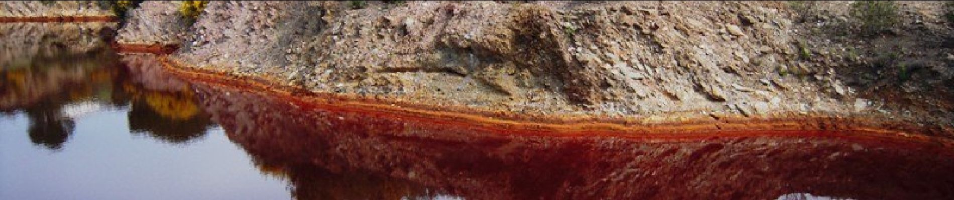
Trail On foot of 13.7 km to be discovered at Alentejo Region, Setúbal, Azinheira dos Barros. This trail is proposed by SityTrail - itinéraires balisés pédestres.

Description

Trail created by Centro de Ciência Viva do Lousal;Município de Grândola.

Symbol: unmarked

Elevation profile

Photos

Positioning

Country:
Portugal
Region :
Alentejo Region
Department/Province :
Setúbal
Municipality :
Azinheira dos Barros
Location:
Unknown
Start:(UTM)
550368 ; 4209931 (29S) N.

Trails nearby

Trail On foot Grândola e Santa Margarida da Serra - Rota da Serra - Photo
On foot
GUIDE+

On foot

Easy
Grândola e Santa Margarida da Serra, Alentejo Region, Setúbal, Portugal
6.1 km | 8.2 km-effort
1h 52min
No


Close
My subscriptions